
Natural Resources
The James River, Hampton Roads and their tributaries provide habitats for a variety of plant and animal species in their tidal and non-tidal wetlands, non-vegetated tidal flats, forested areas and flood plains. Important habits are identified by the Virginia Department of Conservation and Recreation as natural heritage areas, which are home to federal and/or state endangered plants and animals. The shoreline too, is a natural resource because it provides public and private access to the water, habitat for wildlife, and the water quality function of vegetated upland areas. More detailed information on these topics is contained in a technical support document developed to meet the requirements of the State’s Chesapeake Bay Preservation Act.
Tidal and Non-Tidal Wetlands and Associated Regulations
Wetlands are “those areas that are inundated or saturated by surface … water at a frequency and duration sufficient to support, and that under normal circumstances do support, a prevalence of vegetation typically adapted for life in saturated soil conditions. Wetlands generally include swamps, marshes, bogs and similar areas.” (27) “Wetlands possess three essential characteristics: (1) hydrophytic vegetation, (2) hydric soils, and (3) wetland hydrology, which is the driving force creating all wetlands. The three technical criteria ... must ... be met for an area to be identified as wetland. Therefore, areas that meet these criteria are wetlands.” (28)
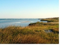 Tidal Wetlands (Popup full image)
|
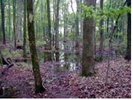 Non-Tidal Wetlands (Popup full image)
|
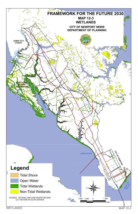
“The (tidal) wetlands found within the City of Newport News ... total 2,883 acres. Of this number approximately 70 percent or 2,029 acres (of wetlands) are located within the boundaries of Ft. Eustis, while the remaining 30 percent or 854 acres are found in the rest of Newport News.” (29) Most obvious non-tidal wetlands are located in creek bottoms. However, there are scattered isolated non-tidal wetlands located elsewhere. The tidal and non-tidal wetlands in the City are illustrated on Map 12-3.
Total environmental value is the combined value of the socioeconomic, environmental and fish and wildlife values of a particular wetland. For management purposes, functional classifications for tidal wetlands have been estimated based on their total environmental value. Although non-tidal wetlands have been classified by type by the Fish and Wildlife Service, there has not been an independent study of each type of non-tidal wetland classification to determine its total environmental value so that the highest quality non-tidal wetlands can be identified and preserved.
"The primary federal program regulating wetlands is Section 404 of the Clean Water Act. The program regulates discharges of dredged or fill material into the waters of the United States, including most wetlands. All states have been given review and certification authority by Section 401 of the Clean Water Act over any federal license or permit that may result in a discharge to waters.” (30) For specific types of non-tidal wetlands permits, the Department of Environmental Quality issues the Virginia Water Protection Permit.
The City's Wetlands Board works with the Virginia Marine Resources Commission and the Corps of Engineers to review applications for activity within the tidal non-vegetated and vegetated wetlands lying between mean low water and mean high water.
Flood Plain and Associated Development Regulations
A flood plain is a relatively flat or low land area adjoining a river, stream, or watercourse subject to partial or complete inundation. Pressure to develop in flood plains persists because waterfronts and riversides are picturesque desirable places to live with access to the water for recreational purposes. As a result of this development interest in the flood plain, the Federal Emergency Management Agency has mapped the 100-year flood plain boundary for communities in flood-prone areas. The flood plains designated by the Federal Emergency Management Agency in 1975 for the City of Newport News were revised in January of 1986.
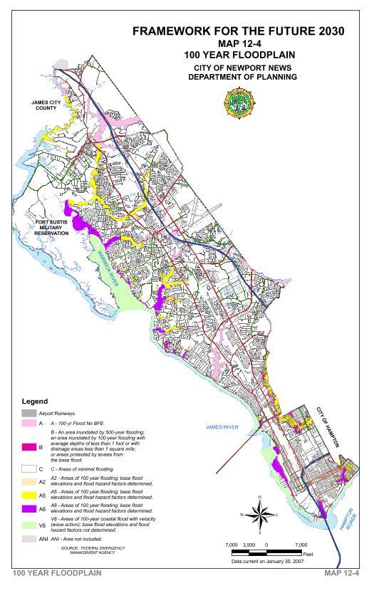
Local flood plains generally follow the coast line of the Hampton Roads Harbor, James River and Warwick River and the major creeks Skiffe’s Creek and Skiffe’s Creek Reservoir, Stoney Run, Lucas Creek, Deep Creek, Fisher’s Creek, government ditch, Brick Kiln Creek, Lake Maury, Sluice Mill Pond, Salter’s Creek and Newmarket Creek. These flood plains are shown on Map 12-4.
Since 1975 the City has had an overlay district for the Flood Hazard Area south of Mercury Boulevard and regulations for flood plain development in the Zoning Ordinance. The Flood Plain Overlay District regulates uses, activities and development that alone or in combination will cause unacceptable increases in flood heights, velocities, and frequencies.
The area that usually floods during storms is along Salter’s Creek. This is the oldest area of the City. It was developed before the National Flood Insurance Program that requires first floor elevations of structures to be above the 100-year flood plain base elevation. When it floods, structures in the flood plain are damaged. The City's Geographic Information Systems Mapping office contracted with the Federal Emergency Management Agency (FEMA) to update the floodplain maps based on actual topography. "The updated maps, minus the Stoney Run watershed that is being studied, have been submitted to FEMA for review. Once the Stoney Run watershed updated floodplain information is submitted, it is anticipated that new effective floodplain maps could be released as early as December 2008." (31)
Flood Events and related Improvements and Regulations Changes
The Task Force Report, Hurricane Floyd Flooding dated November 1999 recommended: the Floodplain Overlay District in the Zoning Ordinance be revised to require structures to be elevated one-foot above the base flood elevation. Other recommendations were the design storm frequency for culvert crossings for interstates and primary highways be changed to the 100-year storm, the use of trash racks be expanded, public education, maintenance of the Colony Pines Dry Basin, further evaluation of the Kiln Creek and Lee Hall Reservoir watersheds and CIP drainage projects for Meadow Creek Drive and Windsor Great Park. All recommendations except the Windsor Great Park drainage projects have been completed. The Windsor Great Park projects will be designed and constructed when the Jefferson Avenue widening project from Buchanan Drive to Kings Ridge Drive is completed.
In 2000, the Corps of Engineers completed a study that recommended flood reduction strategies for Salter’s Creek and Newmarket Creek. Recommendations from the report that have been completed are the replacement of the bridges at 20th and 25th street for Salter's Creek. Recommendations for Newmarket Creek included larger culverts under roads upstream of Chestnut Avenue within the City and channelization downstream of Chestnut Avenue in Hampton. The Department of Engineering has been working with the City of Hampton to develop a comprehensive strategy to deal with flooding along Newmarket Creek.
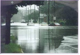
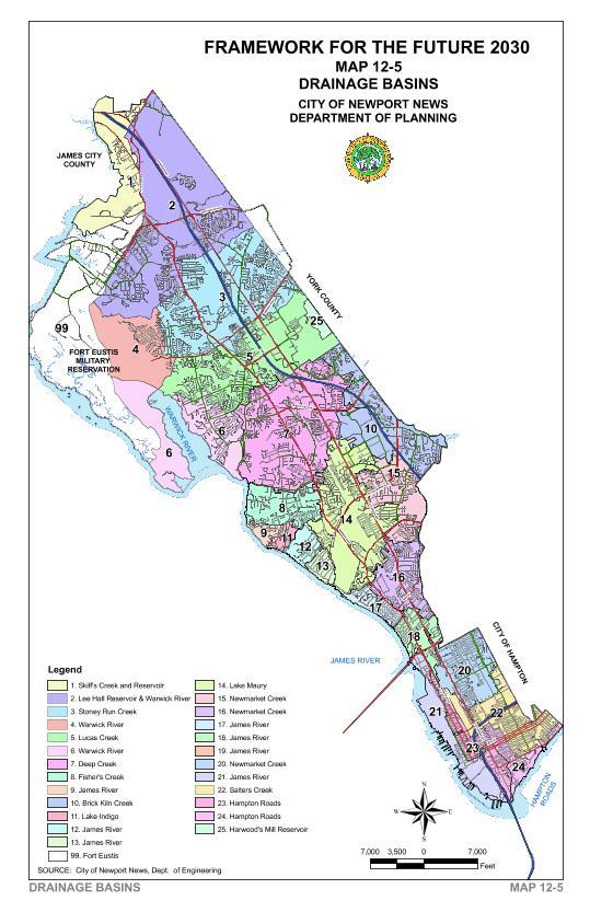
On September 1, 2006 Tropical Storm Ernesto "brought between 7 and 11.5 inches of rainfall depending on the location within the City, with an average of 8.3 inches. The highest City rainfalls, exceeding 10 inches and up to 11.5 inches, occurred near Denbigh Boulevard and Jefferson Avenue(Stoney Run/Windsor Great Park). (32) Tropical Storm Ernesto resulted in an estimated private property damage of $4,072,000.00 and public property damage of $137,109.00. After this storm, the Engineering and Public Works departments prepared a report titled Tropical Storm Ernesto Stoney Run Stormwater Report dated November 2006. As part of and subsequent to this report, the City identified several improvements, which include new stormwater basins and drainage channel improvements that could be made in the Stoney Run drainage system. The Capital Improvement Plan for 2009-2014 includes $3.5 million in stormwater improvements targeted to Stoney Run drainage system over a five year period. "These are in addition to related improvements programmed in the Jefferson Avenue (VDOT-managed) and Richneck Road (City-managed) roadway projects." (33) Map 12-5 identifies the City's drainage basins.
Natural Heritage Areas
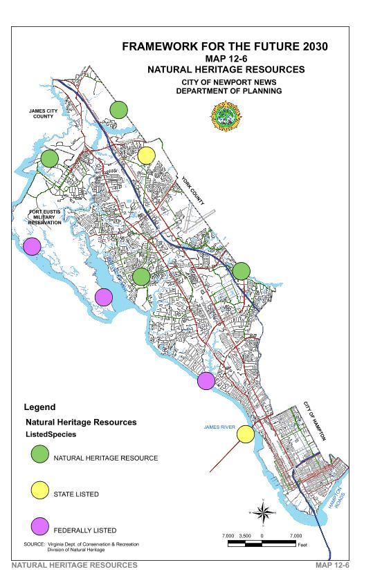
The Virginia Department of Conservation and Recreation (DCR), Division of Natural Heritage, identified eight species that are rare, threatened, or endangered at the State or federal level. Two are birds, one is a reptile and five are plants. The birds are the Peregrine Falcon, which has an endangered status at the state and federal level, and the Bald Eagle that has a threatened status at the state and federal level. The reptile is the Canebrake Rattlesnake that has an endangered status at the state level. The five plants considered “rare or very rare” by the state are Cuthbert Turtlehead, Hazel Dodder, False Hop Sedge, Umbrella Flatsedge and St. John’s-Wort. Map 12-6 shows the general location areas for these natural heritage resources in Newport News.
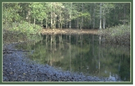
One natural heritage area identified on Map 12-6 is the Grafton Ponds Coastal plain, Seasonal Pond complex. “This wetland complex supports several rare plants and animals for Virginia including, Cuthbert turtlehead, and Mabee’s Salamander and Barking Tree Frog.” (34)
Newport News Shoreline
Excluding the Fort Eustis/Mulberry Creek shoreline, the City of Newport News contains over 100 linear miles of shoreline. This shoreline is the collective total of fourteen creeks and rivers located within the City limits. Because of the existence of erosion control structures, such as cement bulkheads and concrete block riprap, the shoreline located southeast of Deep Creek along the James River and Hampton Roads is considered hardened. Adjacent to this hardened shoreline are saltwater flats. Adjacent to the natural shoreline, north of Deep Creek along the James River and Warwick River, there are saltwater flats and wetlands.
Tree Preservation
The ecological balance among air, soil and water is preserved by the retention of trees, which cleanse storm water runoff, stabilize soils, absorb carbon dioxide, and produce oxygen and water vapor. The City preserves trees through the Site Development Regulations, Zoning Ordinance, Chesapeake Bay Preservation Ordinance, and by supporting the Newport News Green Foundation.
An ordinance is needed to protect the “Champion Heritage Trees” from destruction during the development process. A Champion Heritage Tree is defined as any tree that has been determined by a City Arborist or Landscape Architect to be protected against removal or physical damage because of the tree’s size, age, species, form, rarity, historical significance, wildlife habitat or some other professional criteria.
Large trees that are six (6) inches or greater in diameter at breast height located in green areas on site plans, are to be protected by a temporary fence or barrier. The temporary fence or barrier is located and maintained five-foot outside the tree's drip line. Vegetated transitional area buffers are preserved between lower intensity and higher intensity zoning districts. This buffer is required to have a minimum of two trees and two evergreen shrubs for every 400 square foot area.
A 100-foot vegetative buffer is preserved on developing parcels adjacent to tidal wetlands, non-tidal wetlands hydrologically connected by surface flow to tidal wetlands, or water bodies with perennial flow.
- EPA, 40 CFR 230.3 and CE, 33 CFR 328.3
- Interagency Cooperative Publication, Federal Manual for Identifying and Delineating Jurisdictional Wetlands, January 10, 1989, Page 5.
- Virginia Institute of Marine Science, City of Newport News and Fort Eustis Tidal Marsh Inventory, April 1977, Page 2.
- American Planning Association, Planner Advisory Service, Report Number 412/413, Protecting Nontidal Wetlands, 1988, Page 17.
- Per a conversation with Ben Scott, Newport News GIS Mapping, March 12, 2008.
- Topical Storm Ernesto, Stoney Run Stormwater Report, City of Newport News, November 2006, Page 4.
- Ibid Page 21
- Department of Conservation and Recreation, Division of Natural Heritage web site, http:// www.state.va.us/~dcr/dnh/grafton.htm.