
Activity Centers
Neighborhood Centers
Many commercial and industrial areas in Planning District I are in activity centers. The least intensive are the neighborhood centers. Neighborhood centers provide services that are more personal in nature and are neighborhood oriented, such as convenience stores, churches, personal service establishments (e.g., barber shops, beauty shops, laundry and dry cleaners, libraries, parks and schools). They are gathering places for neighbors and friends and are accessible by walking. Some of the neighborhood centers in Planning District I have uses that are community oriented, such as the Dochiki Social Club, located in the Chestnut Avenue neighborhood center. The other neighborhood centers in the planning district are Wickham Avenue, Salter's Creek and Marshall Avenue.
Neighborhood and community centers in Planning District I are urban. They were designed and developed before the automobile became the prevalent mode of transport. The buildings are on small lots and off-street parking usually is not provided. The centers cater to pedestrian traffic. In this area suburban parking requirements are inappropriate because they restrict the introduction of new uses. In these centers suburban parking requirements cannot be met because of small lot sizes. The centers cannot become viable when retail spaces cannot be leased due to suburban parking requirements. To alleviate the problem, the city amended the zoning ordinance to eliminate the parking requirement for commercially zoned property within the Neighborhood Conservation District.

A new neighborhood center is planned at the Marshall Avenue/39th Street intersection. A Shipyard office building is currently located on the northwest corner. Across the street is a school, the Peninsula Institute Community Health Center, a church and a grocery store. A neighborhood center at this location would be ideal for shopping and recreation. The City of Newport News has designated the area on 39th Street between Marshall Avenue and Orcutt Avenue for the construction of a neighborhood shopping center anchored by a major grocery store.
In addition, a neighborhood center in the North End/ Huntington Heights Community is recommended by the Maritime Center Plan.
Community Centers
Community centers provide services that require a larger market area for support than neighborhoods centers. The portion of Jefferson Avenue located between 18th Street and 39th Street has buildings that are historic and designed for mixed uses. The historic storefronts in this community center allow for second story residential units which provide eyes on the street and assist in reducing crime. Uses within the centers range from grocery stores to clothing outlets, billiard parlors and churches.
Regional Centers
The two regional centers in the district are the downtown Maritime Center and Newmarket.
1. Newport News Maritime Center Plan
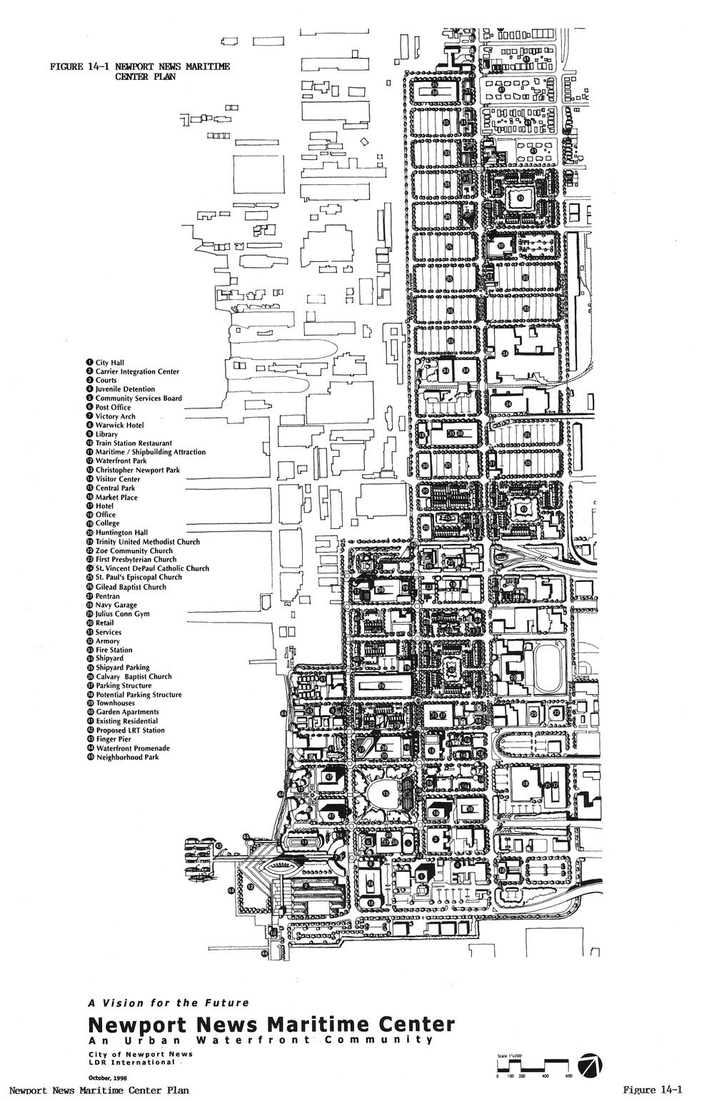
A plan for Downtown was completed by LDR, International, Inc---The Maritime Center Plan (See Figure 14-1). The plan covers the area between the waterfront, the CSX Railroad, 51st Street and 23rd Street. The Maritime Center Plan develops a vision for the future of Downtown Newport News that would result in increased property values, a higher quality of life for area residents and new uses for parcels that have been vacant for some time.
The Maritime Center Plan themes are briefly discussed below.
A. Waterfront
The treatment of the Newport News waterfront will balance the traditional amenity of waterfront development with the uniqueness of an active industrial waterfront. Newport News has active, viable industrial operations on its waterfront. This makes the visitor experience in the waterfront unique, and requires Newport News to approach its waterfront differently from other places.
Virginia Advanced Shipbuilding and Carrier Integration Center
The Maritime Center Plan centers around the Herbert Bateman Virginia Advanced Shipbuilding and Carrier Integration Center (VASCIC). This $90 million state-of-the-art facility provides technical expertise, testing, and analysis for the next generation of aircraft carriers. This facility allows the City of Newport News to market the area as a highly specialized community that will generate spin off economic investments through related businesses, retail, and restaurants. VASCIC covers approximately seven acres of property, injects millions of dollars and bring several hundred workers into Downtown Newport News.
Waterfront Park
The Maritime Center Plan resulted in a new bulkhead and waterfront park, Victory Landing Park, adjacent to the VASCIC facility. A goal of the plan
is to eventually accommodate tour boats to the area in the future.
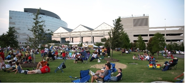
A waterfront promenade is recommended to expand the waterfront park from 31st Street to Victory Landing Park. Due to funding
constraints, the promenade has not been constructed. However, it is recommended that the City move forward with the design
and construction of the project as funding is available.
Tourist Attraction
The Maritime Center Plan identifies the land adjacent to VASCIC for a tourist attraction. This option, or a hospitality use, can be viewed as a long range goal of the City. The Greek Orthodox Church, a City-owned building, is identified as an historic structure for restoration and reuse. The church should be restored for reuse such as a City museum and visitors' center or as an upscale restaurant.
Christopher Newport Park
This park should be linked to the plaza at VASCIC and to the Superblock. The City should continue to prune the lower limbs of the trees in the park to open views of the waterfront.
B. Central Park
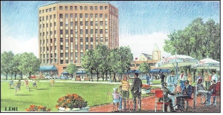
The Maritime Center Plan identifies a business district to be centered around the Superblock. Civic uses and private investments will create activity in and around the park. Renovating the Superblock will create private sector interest.
Marketplace
Putting a marketplace in the superblock would serve the workers, residents and other daytime populations. The marketplace, providing small eateries and retail shops, will anchor the Central Park district.
Property north of the park should be used for a hotel, mixed use office and retail space. The hotel with a parking facility would incorporate retail development on the ground floor. It would be an opportunity to bring workers and visitors back to the Maritime Center.
26th Street Gateway
26th Street is the closest access to the waterfront and the downtown area. A gateway should be constructed to welcome and invite visitors to the Maritime Center.
New Parking Facilities
As downtown develops with offices, mixed use developments and hotels, a challenge will be providing additional parking. Four sites in the downtown area are recommended as primary parking locations: 1) replace the Community Services Board parking deck; 2) the proposed office building and hotel complex adjacent to Central Park; and, 3) a new garage between 26th and 27th Streets.
Office Locations
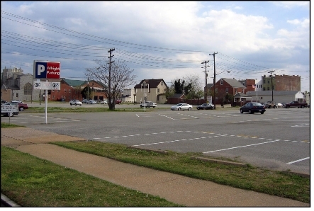
Offices are recommended in addition to the office development included in Central Park. The locations of these offices capitalize on any spin-off of investment from the VASCIC facility.
C. Residential Neighborhoods
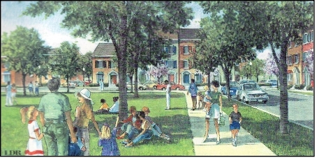
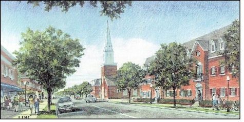
The Maritime Center Plan recommends that new residential development be clustered around existing churches and new park squares. These residential neighborhoods should have commercial businesses nearby serving the residents and workers in the area.
Retail Uses
Washington Avenue provides an opportunity for infill development that can accommodate new retail uses. This allows existing older buildings to be rehabilitated.
Park Squares
Small, park squares create open space where townhouses can develop around. Each park will establish a sense of place and increase property values around them.
Housing
The Maritime Center Plan recommends townhouses and garden apartments around new parks and existing churches. Garden apartments should be three or four story buildings having entrances directly to the sidewalks. They would be located on Huntington, Washington, and West Avenues. Townhouses would face the small, urban parks. Housing would be designed to attract young, middle to upper income professionals and other people who would enjoy living in an urban setting.
Parking in these residential neighborhoods would be accommodated by the parallel parking around the park squares, parking spaces located underneath residential units and on-street parking.
D. Shipyard Gateway
The plan recommends creating a formal entryway to the Maritime Center. Landscaped islands should be developed between the exit ramps from Interstate 664 and 34th and 35th Streets. It also recommends that the "Dorothy" be placed in the island to announce the entrance into the Maritime Center.
Mixed Use Facility
The land between 34th and 35th Streets provides the chance for a mixed use complex with office buildings, a parking structure, a hotel, restaurant and retail. This area is convenient to the Shipyard, I-664 and the Maritime Center. The City could develop this mixed use project over time as the market demand increases.
College Campus
The Maritime Center Plan recommends a college campus on Washington Avenue to serve Navy Personnel, Shipyard Employees, and other citizens. This institution can start in one of the existing buildings and as it grows it can enlarge or construct its own building. A regional urban studies program sponsored by universities in Hampton Roads would be logical for this institution.
Light Rail Station
The HRT bus terminal provides easy access to and from the Shipyard, the new educational institution and any new office space that is developed. The light rail system will improve access to the Greater Hampton Roads Area for its downtown residents.
Service Station
The Maritime Center identifies the lack of commercial services in the area and recommends a location which has easy access to Interstate 664 to accommodate both local and through traffic.
E. Shipyard Parking/Industrial
This is a service area for the Shipyard and a transitional area between the North End/Huntington Heights community and the Maritime Center.
Street Edge Landscaping
Well-landscaped edges along Huntington Avenue and Warwick Boulevard buffer the parking lots along these corridors and create an entryway for the core of the Maritime Center. This treatment should be continued.
Parking Garage
A parking garage on 50th Street increases parking spaces and creates a boundary to the Shipyard Industrial Area.
F. North End/Huntington Heights Service Center
The North End/Huntington Heights Community will be anchored by the Huntington Heights Service Center. This is an important feature. It buffers the existing neighborhood from shipyard parking and creates economic improvements for the area. This service center will develop around the Calvary Baptist Church. The service center should include a supermarket, service and retail uses, and residential units comprised of townhouses and garden apartments.
2. Newmarket
Newmarket is the second regional center in Planning District I. The Newmarket Regional Center is different from the Maritime
Center in that it is not pedestrian oriented. Newmarket Center, is the cornerstone of the center. But it has declined and
lost most of its major retail anchors and other tenants. It is surrounded by the former Newmarket South shopping center, smaller shopping centers, offices, restaurants, a motel
and a car dealership. Part of the center is located in Hampton.
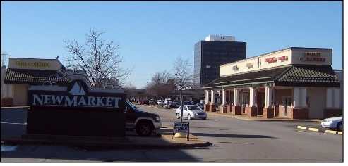
Although located strategically at the Mercury Boulevard and Jefferson Avenue intersection, Newmarket Center has not been able to attract new major tenants. Large surface parking lots are provided for all uses. In addition, pedestrian access across arterial streets is difficult. Because of the lack of commercial retail interest, the center has been recently redeveloped into an office park. The City is considering a joint planing project with the City of Hampton to help define the future of the Newmarket area.
Hampton Roads Tourist Seafood Center
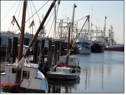
The Hampton Roads Tourist Seafood Center is recommended near the 12th Street/I-664 interchange. Regional facilities at this location would take advantage of the Seafood Industrial Park employment center. It is the only City-owned working harbor in the area and one of the last remaining working harbors in the region. A seafood center with an open air seafood market in conjunction could be a regional attraction.
Employment Centers
The District's employment centers are achttp://nngov.limehouse.com/creation/#cessible to Interstate 664. They provide needed jobs within proximity to local residents and employ workers who live outside the Planning District.
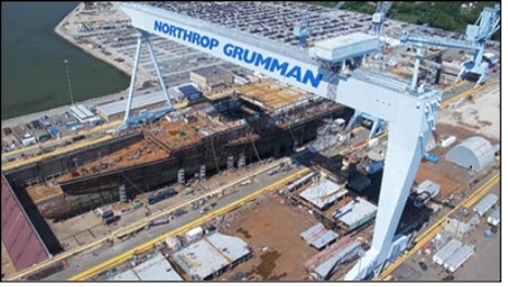
The industrial centers are the Northrop Grumman Newport News Shipbuilding formerly Newport News Shipbuilding, the CSX/port/coal terminals and the Seafood Industrial Park located at the southern tip of Jefferson Avenue.
Northrop Grumman has over 18,000 employees. It is the largest industrial employer in the Commonwealth of Virginia. Northrop
Grumman has relocated over 1,600 engineers to downtown into the renovated Sears and VSS Buildings. The VASCIC facility employs
700 additional engineers engaged in designing the next generation of aircraft carriers and warships. In 2006, Northrop Grumman
added to its complex with the construction of a 60,270 square foot, three story production and maintenance training facility
that provides technical training for shipyard employees.
The Newport News Seafood Industrial Park is located near Downtown with immediate access to I-664. This 30 acre industrial park is zoned for marine related industry. It is recommended that the City explore the opportunities of other commercial uses in the park such as an open air seafood market.
The CSX Railroad provides rail service to the Newport News and Portsmouth Marine Terminals. This corridor is the only rail access available for imports/exports to the Newport News Marine Terminal and the coal piers. The right of way of CSX has been identified as a future transportation corridor for a light rail system and commuter rail service to Richmond.
The Hampton/Copeland/Newport News Industrial Park, which has developed with light industry, is located off of Chestnut Avenue. It is recommended that a major landscaping, tree planting, and enhancement project be implemented to improve the appearance of the Industrial Park. Such improvements should complement the improvements that were completed for the portion of the park located in the City of Hampton.
In the Jefferson Park area, an industrial center is recommended between the CSX railroad and Jefferson Avenue north of 39th Street. This will replace the deteriorated residential uses and marginal/industrial uses east of the CSX railroad.
The City has cleared property between Terminal and Jefferson Avenues extending from 28th Street to 35th Street. The site's combination of easy access to the Hampton Roads region provides for mixed use opportunities, included a grocery store and other retail uses.