
14 THE LAND USE PLAN
Introduction
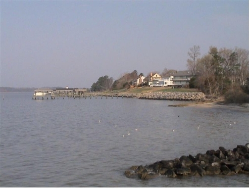
Planning District III extends from Skiffes Creek and the James City County line on the north, to Deep Creek on the south and from the James River on the west, to the CSX railroad on the east. Commonly referred to as "Denbigh," after its best-known historic settlement, Planning District III was settled during the earliest times of Colonial America. It features 29 miles of shoreline along the scenic James and Warwick Rivers and a rich natural environment of tidal creeks, marshlands and forests. Over 8,000 acres of the District are part of Fort Eustis, which is the City's largest military installation. Planning District III has developed as a suburban residential area over the past 35 years, with commercial development along Warwick and Denbigh Boulevards, which are its main transportation arteries. Pockets of open land, a wealth of historic sites and other vestiges of its historic rural past remain throughout the District.
Population and Housing
The population of Planning District III was 56,268 in January of 2007 or thirty percent of the City’s population. District III's population had a slight decrease of one percent from its 2000 population of 59,082, while the City of Newport News grew one half percent over this six year period. As of January 2008, the District contained 22,131 housing units. Less than five percent of its housing units were estimated to be vacant. Housing is discussed further in Chapter 7.
|
Housing Units 12/31/07 |
||||
|---|---|---|---|---|
|
Planning District |
Single Family |
Multi-Family |
Mobile Homes |
Total |
| I |
8,076 |
6,653 |
388 |
15,117 |
| II |
16,640 |
13,712 |
847 |
31,199 |
| III |
12,970 |
8,288 |
873 |
22,131 |
| IV |
4,904 |
5,061 |
265 |
10,230 |
| Total |
42,590 |
33,714 |
2,373 |
78,677 |
Land Use
Existing land use in Planning District III is predominately single-family residential, with strip commercial along Warwick Boulevard and Denbigh Boulevard. Almost half of its land is part of Fort Eustis and under the jurisdiction of the U. S. Army. Approximately 26 percent of the planning district has been developed as residential, while less than 2 percent is in commercial or office use and 2.6% is industrial use. The existing land use composition of District III is summarized in Table 14-11.
|
Land Use Comparison Planning District III (2000-2007) |
||||||
|---|---|---|---|---|---|---|
|
Land Use |
2000 |
2007 |
Change (2000-2007) |
|||
|
Acres |
% Total |
Acres |
% Total |
Acres |
% Δ |
|
| Park/Open Space/Wetlands |
1,392 |
8.0% |
1,271 |
7.3% |
-121 |
-8.7% |
| Residential |
4,312 |
24.7% |
4,462 |
25.5% |
150 |
3.5% |
| Commercial |
338 |
1.9% |
316 |
1.8% |
-22 |
-6.6% |
| Office |
61 |
0.3% |
58 |
0.3% |
-3 |
-4.3% |
| Industrial |
458 |
2.6% |
460 |
2.6% |
2 |
0.4% |
| Community Facility |
486 |
2.8% |
617 |
3.5% |
131 |
27.0% |
| Transportation/Utility |
189 |
1.1% |
207 |
1.2% |
18 |
9.3% |
| Military/Federal Owned |
8,374 |
47.0% |
8,374 |
47.9% |
0 |
0.0% |
| R-O-W/Road System |
830 |
4.7% |
852 |
4.9% |
22 |
2.6% |
| Total Developed Acreage |
16,440 |
94.1% |
16,617 |
95.1% |
177 |
1.1% |
| Vacant |
1039 |
5.9% |
862 |
4.9% |
-177 |
-17.0% |
| Total Acreage |
17,479 |
100% |
17,479 |
100% |
0 |
0.0% |
History of Growth and Development
The lands of present day Planning District III were settled by the English shortly after the establishment of Jamestown, 10 miles away. In 1618, 1,000 acres on Mulberry Island (which is now Ft. Eustis) were patented by Virginia Governor Sir George Yeardley and were put under cultivation.
The Planning District was once in the Warwick River Shire, one of the original eight political subdivisions of the Virginia Colony, was established in 1634.
One of the most influential early Warwick planters was Captain Samuel Mathews who, in the early 1620s, established a plantation at the confluence of the Warwick River and Deep Creek which was later named "Denbigh."
Denbigh and Mulberry Island were thriving centers of activity during colonial times as Warwick attracted tobacco and wheat planters from England. Between 1680 and 1691, “Warwicktown” was founded at the mouth of the Warwick River and Deep Creek as the seat of County government on what is now the City Farm. Lots were laid out and a courthouse, ordinary, tobacco warehouse and jail were built.
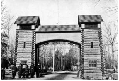
While the southern tip of Warwick County became the City of Newport News in 1896, the majority of Warwick County remained rural agricultural land until the mid-20th Century. In 1897, Mennonites from Pennsylvania and the mid-west established a 1,200-acre "colony" on the Warwick River. Their hard work and sensitivity to land stewardship restored the fertility of the soil. Before long, “the Colony" became a productive agricultural community with orchards, vegetable farms and dairies.
In March 1918, Camp Abraham Eustis was built on Mulberry Island. Many residents of the historic Mulberry Island community
were relocated to the Jefferson Park area of the City. Camp Eustis was re-designated Fort Eustis in 1923. In 1962, Ft. Eustis
became the headquarters of the U.S. Army Transportation Corps.
World War II brought boom times to shipbuilding and military installations in Newport News. This greatly affected all of Warwick County and the Peninsula. Warwick County began growing as upper-and middle-income residents moved from the urbanized parts of Newport News to newly forming suburbs. Commercial development followed the population movement and small strip shopping centers sprang up along Warwick Boulevard, the County's main transportation artery.
In 1952, to improve the provision of infrastructure and services to its growing suburbs, the burgeoning county was incorporated as the City of Warwick. On July 1, 1958, Warwick City consolidated with the City of Newport News. This gave what had become a "bedroom community" an instant industrial tax base, but some felt that Warwick's rich identity had been lost. Since then, Planning District III continued to grow predominately as a suburban residential area, with strip commercial development increasing along its arterial streets.
Since 1990, when the Planning District started approaching build-out of its land area, the pace of growth has slowed. The residents of Planning District III seek to preserve and enhance their quality of life and restore a special sense of identity as the District and its neighborhoods mature.
Issues
Current issues in Planning District III are:
- Enhance neighborhoods by preserving a sense of community and serving them with excellent schools, parks, churches and other facilities and amenities.
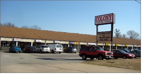
- Redevelop and improve commercial strips into quality neighborhood centers that provide a dynamic visual experience along arterial boulevards.
- Create a sense of place and quality of life that complements the District’s natural and historic heritage.
- Preserve and restore public access to the natural and historic resources of the district, including its rivers, creeks, forests,
farmland, marshland and historic sites.
- Provide adequate recreational opportunities serving the diverse age groups and interests of the District's population.
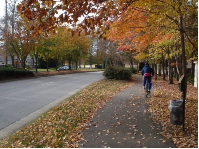
- Create a district that is served by effective and convenient public transit and can be safely and enjoyably traversed by bicycle or on foot.
- Develop an economically healthy district with increased employment opportunities to serve its population that is compatible with its quality of life.