
14 THE LAND USE PLAN
Introduction
Planning District IV is located in the northeast quadrant of the City. The boundaries of the District are York County on the north and east, the CSX Railroad to the west, and airport on the south. In 2007, a land transfer with York County added 397 acres to the district between Denbigh boulevard and Fort Eustis Boulevard along the York County line in exchange for 87 acres of property located on the U.S. Naval Weapons Station in Yorktown.
Once known as Richneck, Planning District IV was settled in 1667 when Miles Cary established Richneck Plantation. Most development in the planning district occurred after the 1970's. The planning District is the smallest in land area of the four City planning districts. the district is primarily residential in character with two large land uses- Newport News-Williamsburg International Airport and Newport News Park.
Population and Housing
As of January 1, 2007, the estimated population of Planning District IV was 25,746 and the total number of housing units was 10,230.
|
Housing Units 12/31/07 |
||||
|---|---|---|---|---|
|
Planning District |
Single Family |
Multi-Family |
Mobile Homes |
Total |
| I |
8,076 |
6,653 |
388 |
15,117 |
| II |
16,640 |
13,712 |
847 |
31,199 |
| III |
12,970 |
8,288 |
873 |
22,131 |
| IV |
4,904 |
5,061 |
265 |
10,230 |
| Total |
42,590 |
33,714 |
2,373 |
78,677 |
Since 2000, residential development has slowed down in the district. However, two new mixed use developments are planned for the future- Asheton in Lee Hall and Huntington Pointe in the expansion area that was added to the City in 2007.
Land Use
Existing land use in the district is summarized on Table 14-13 and illustrated on Map 3-1.
As of December 2007, approximately twenty (20) percent of the land area is residential, three (3) percent commercial, one (1) percent office and three (3) percent industrial in use. Approximately twenty-six (26) percent of the District is used for Park/Open Space/ Wetlands with most of the park land in Newport News Park (Approx. 2000 acres). Approximately, twelve(12) percent of the District is used for Transportation and Utilities with much of this land in Newport News/Williamsburg International Airport (Approx. 900 acres). About fourteen (14) percent is in street and railroad rights-of-way. The airport, Newport News Park, and rights-of-way are half the land area in the District.
As of 2007, about eighteen percent (18%), or 1,420 acres of the District's total land remains undeveloped. However, much of this land is proposed for new development that includes Asheton and Huntington Pointe, which combined together will account for a total of 4,150 new residential units.
|
Land Use Comparison Planning District IV (2000-2007) |
||||||
|---|---|---|---|---|---|---|
|
Land Use |
2000 |
2007 |
Change (2000-2007) |
|||
|
Acres |
% Total |
Acres |
% Total |
Acres |
% Δ |
|
| Park/Open Space/Wetlands |
1,963 |
25.5% |
1,916 |
22.6% |
-47 |
-2.4% |
| Residential |
1,517 |
19.7% |
1,494 |
17.7% |
-23 |
-1.5% |
| Commercial |
235 |
3.0% |
336 |
4.0% |
101 |
43% |
| Office |
54 |
0.7% |
297 |
3.5% |
243 |
450% |
| Industrial |
237 |
3.1% |
55 |
0.6% |
-182 |
-76.8% |
| Community Facility |
247 |
3.2% |
297 |
3.5% |
50 |
20.2% |
| Transportation/Utility |
913 |
11.8% |
904 |
10.7% |
-9 |
-1.0% |
| Military/Federal Owned |
83 |
1.1% |
0 |
0.0% |
-83 |
-100% |
| R-O-W/Road System |
1,107 |
14.4% |
1,196 |
14.1% |
89 |
8% |
| Total Developed Acreage |
6,356 |
82.4% |
6,495 |
76.7% |
139 |
2.2% |
| Vacant |
1,353 |
17.6% |
1.969 |
23.3% |
616 |
45.5% |
| Total Acreage |
7,709 |
100.0% |
8,464 |
100.0% |
755 |
9.8% |
History of Growth and Development
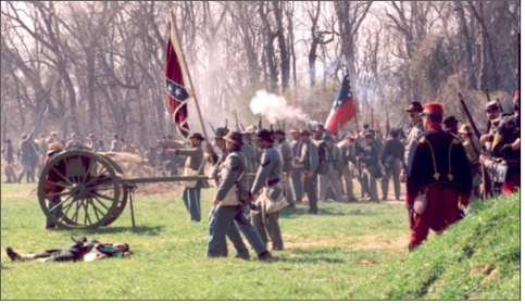
Located north of Lee Hall Reservoir, Endview Plantation was established in the 18th Century by the Harwood Family. In the 19th Century, Lee Hall Manor was built on Yorktown Road by Richard Decatur Lee. Later in the century, Lee Hall Station and Lee Hall Village developed. In January 2004, the Hampton Roads Sanitation District completed the construction of a force main from Warwick Boulevard up Yorktown Road to Crafford Road. Since the force main was constructed and City wastewater collection lines were extended along Crafford Road, forty-three (43) new single family lots have been platted. As of Fall 2007, the zoning has been completed and preliminary development plans for the Asheton development have been submitted for review by the City. The Asheton Development is a mixed use development with 1,600 housing units proposed on three sites near Lee Hall centered around the preserved historical Endview Plantation property.
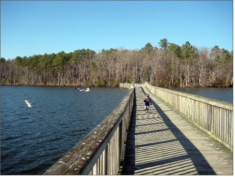
Lee Hall Reservoir was established August 8, 1889 by Old Dominion Land Company as the Newport News Light and Water Company. The City of Newport News bought the system on June 30, 1925. Newport News Park was developed on reservoir property in the 1960's. It contains more than 8,000 acres with 2,000 acres in Newport News and 6,000 acres located in York County. Newport News Park is the largest municipal park east of the Mississippi River and the second largest City Park in the country.
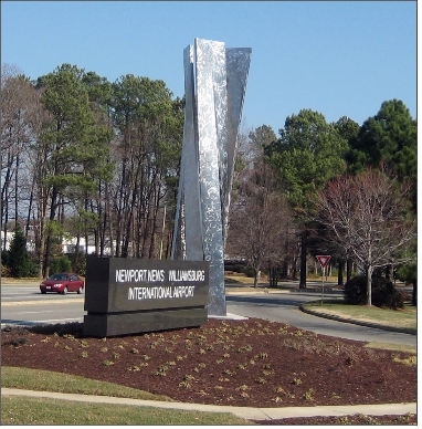
The Patrick Henry CommerCenter was created on 200 City owned acres for industrial and office development. This land, outside the boundaries of the land regulated by the Federal Aviation Administration, was formerly owned by the Peninsula Airport Commission. The Newport News/Williamsburg International Airport has steadily increased its passengers boardings as the airport continues to expand its aviation operations. Airport expansion plans in the future include a third parallel runway.
In 2007, the City exchanged property with York County through a mutual boundary line adjustment agreement. The City transferred 87 acres of Naval Weapons Station property to York County and acquired 397 acres of vacant land located east of the Colony Pines subdivision between Denbigh Boulevard and Fort Eustis Boulevard. The majority of the vacant land is being proposed for a urban mixed use development currently called Huntington Pointe.
Issues
Issues facing Planning District IV are:
- Providing neighborhoods with schools, parks, libraries and recreation centers and other facilities and amenities.
- Maintaining public infrastructure (streets and utilities, such as waste water collection, regional stormwater management, flood control, and ditch maintenance).
- Providing new public infrastructure (roads and utilities, such as waste water collection, regional stormwater management,
and flood control) improvements prior to development of land.
- Preserving the natural and historic resources in the District, including creeks, forests, marshland and historic sites and providing public access to these.
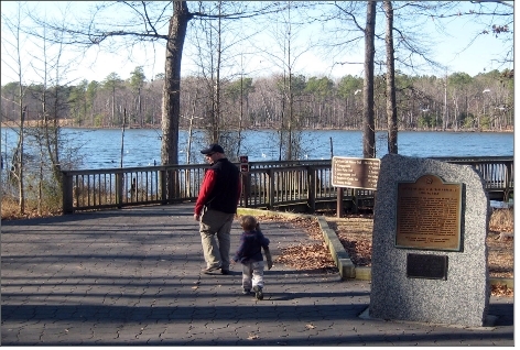
- Providing convenient and effective public transportation including pedestrian and bicycle access.
- Providing effective traffic management.
- Providing Community Policing.
- Diversifying the retail commercial base along the Jefferson Avenue corridor from the Interstate 64 interchange with Jefferson
Avenue to Fort Eustis.
- Provide a police and fire stations centralized to Planning District IV.
- Diversifying the local economy through balanced and managed expansion and development of new employment centers.
- Protecting neighborhoods and their integrity from incompatible fringe and infill development.
- Providing effective Codes Compliance.
- Preserving trees on the remaining large undeveloped parcels.
- Providing for the educational needs of all children.
- Protecting the airspace and property around the Newport News Williamsburg Airport.
- Providing effective management of the Huntington Pointe and Asheton developments to ensure that the projects are built and
well-designed according to their respective design guidelines.
- Eliminating continuous commercial strips by promoting the cluster shopping center concept in mixed use activity centers.
- Integrating land uses to provide jobs and living areas in close proximity while minimizing incompatibilities between nonresidential and residential land uses.