
Parks and Open Space
Parks
Although twenty-six (26) percent of Planning District IV is used for Parks and Open Space, most of that land is in Newport News Park. The Planning District lacks community, district, and neighborhood parks. Ideally, the District should have one district park, two community parks, and six additional neighborhood parks.
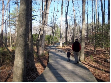
Neighborhood parks within walking distance of most residents are needed. In order to provide the neighborhood parks in Planning District IV an aggressive park acquisition and development program should be implemented. Also, recreational equipment should be improved at school sites that provide for neighborhood recreation. New park areas are planned in both the Asheton and Huntington Pointe developments, and both have trail that connect to the Newport News Park trail system.
The Stoney Run District Park and the North District Recreation Center will become accessible to Planning District IV after Atkinson Boulevard is constructed to Jefferson Avenue.
Greenways
Greenways in the District follow the headwater creeks of Curtis Run, Lebanon Run, Stoney Run, and Lucas Creek. Past development practice was to pipe, fill, or relocate the natural headwater creeks. This practice has ceased and natural flood plains will be respected and kept undeveloped to reduce the potential for future flooding.
Curtis Run and Lebanon Run are located on the Asheton property. They drain into the Lee Hall Reservoir. Both Curtis and Lebanon Run receive raw water discharge from outfalls of Newport News Waterworks next to the Endview property. These outfalls receive 50-million gallons daily (MGD) of water that is piped from the Chickahominy River, Diascund Reservoir in New Kent County, and Little Creek Reservoir in James City County. The raw water then flows to the Lower Lee Hall Reservoir where it is treated for distribution at the Lee Hall Treatment Plant by Newport News Waterworks. Future development around these creeks requires water quality protection. Areas adjacent to the stream corridor and ponds should be considered for future acquisition for inclusion in the greenway system.
The creek located on a portion of Asheton development adjacent to Lee Hall Mansion property drains into Skiffe's Creek Reservoir. Future development will be required to use appropriate Best Management Practices required by Waterworks to protect water quality from pollutants in stormwater runoff. This creek should be incorporated into the greenway system.
Jones Run is a creek whose flow was redirected to the Warwick River. The Jones Run diversion project was built to protect the Lee Hall Reservoir from pollutants caused by upstream development. Becasue the natural character of this creek was altered, it is not a priority acquisition for the greenway system.
The headwaters for Stoney Run, located in the Richneck and Charter Elm/Hanover Heights neighborhoods, have remained in their natural state west of Jefferson Avenue. They are on vacant land near the intersection of Jefferson Avenue and Denbigh Boulevard. These headwater creeks should be included in the greenway system.
The headwaters of Lucas Creek, located in the Turnberry neighborhood, remain largely in their natural state and are protected by the local Chesapeake Bay Preservation regulations. These headwaters should be added to the greenway system.
Natural Areas
Portions of the greenway system between developed areas, should be left as natural open space. Greenway buffers between incompatible uses along the Amoco rail spur line should be natural areas that are part of the greenway system.
The Grafton Sink Hole Ponds located on watershed property between Denbigh and Fort Eustis Boulevards have been protected from development as a natural preserve. Newport News Waterworks, the Department of Parks and Recreation, and the U.S. Army Corps of Engineers are studying the expansion of the natural preserve by adding another 200 acres between the Amoco rail spur line and Denbigh Boulevard. This is being done to mitigate wetlands losses from the expansion of the airport.