
14 THE LAND USE PLAN
Introduction
Planning District II is geographically bounded by Mercury Boulevard and Huntington Park to the south, the James River to the west, the City line to the east and Deep Creek and the NewportNews-Williamsburg International Airport to the north.
Planning District II covers the central part of the City and contains the City's third largest employment center, Oyster Point.
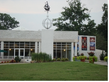
The District contains the regional and educational assets such as the Mariners' Museum, the Peninsula Fine Arts Center, the
Virginia Living Museum, Riverside Regional Medical Center, and Christopher Newport University concentrated along Avenue of
the Arts. This concentration of museums is transforming this area into the City's cultural corridor. Moreover, the area shares
in the rich history of the early settlers of colonial times. The District has retained this history despite rapid suburban
growth after World War II.
Population and Housing
Planning District II has 31 percent of the total land area of the City, making it the second largest planning district. The estimated 2007 population for District II is 71,620 people, which is approximately 38 percent of the City's population.
|
Housing Units 12/31/07 |
||||
|---|---|---|---|---|
|
Planning District |
Single Family |
Multi-Family |
Mobile Homes |
Total |
| I |
8,076 |
6,653 |
388 |
15,117 |
| II |
16,640 |
13,712 |
847 |
31,199 |
| III |
12,970 |
8,288 |
873 |
22,131 |
| IV |
4,904 |
5,061 |
265 |
10,230 |
| Total |
42,590 |
33,714 |
2,373 |
78,677 |
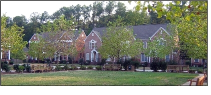
The total number of housing units is 31,199. This represents a three percent increase since 2000. The existing housing stock is in good condition. Recent housing developments include Port Warwick, City Center at Oyster Point, Patrick Henry Place, the Meridian Park apartments, the Chesapeake Retirement Community, and many new dorms located at Christopher Newport University. Port Warwick, City Center, and Patrick Henry Place represent the latest trends in walkable, new urbanist communities.
Land Use
Existing land use in Planning District II is predominately single-family residential with strip commercial development along the major thoroughfares of Warwick Boulevard, Jefferson Avenue and J. Clyde Morris Boulevard. Nearly half of total land area (44%) has been developed as residential, while only six percent is in commercial use 2.6 percent is in office, and 5.8 percent is in industrial uses.
|
Land Use Comparison Planning District II (2000-2007) |
||||||
|---|---|---|---|---|---|---|
|
Land Use |
2000 |
2007 |
Change (2000-2007) |
|||
|
Acres |
% Total |
Acres |
% Total |
Acres |
% Δ |
|
| Park/Open Space/Wetlands |
1,312 |
9.6 |
1,284 |
9.3% |
-28 |
-2.2% |
| Residential |
5,944 |
43.3 |
6,068 |
44.2% |
124 |
2.1% |
| Commercial |
824 |
6.0 |
809 |
5.9% |
-15 |
-1.8% |
| Office |
315 |
2.3 |
364 |
2.6% |
49 |
15.4% |
| Industrial |
768 |
5.6 |
798 |
5.8% |
30 |
3.9% |
| Community Facility |
1,075 |
% |
1,037 |
7.5% |
-39 |
-3.6% |
| Transportation/Utility |
72 |
0.5% |
47 |
0.3% |
-25 |
-34.3% |
| Military/Federal Owned |
0 |
0.0% |
0 |
0.0% |
0 |
0.0% |
| R-O-W/Road System |
2,206 |
16.1% |
2,320 |
16.9% |
114 |
5.2% |
| Total Developed Acreage |
12,516 |
91.2% |
12,726 |
92.7% |
210 |
1.7% |
| Vacant |
1,215 |
8.8% |
1,005 |
7.3% |
-210 |
-17.3% |
| Total Acreage |
13,731 |
100.0% |
13,731 |
100.0% |
0 |
0.0% |
Over 92 percent of the District has been developed. Only 1,005 acres, or 7.3 percent of Planning District II, is still vacant. Assuming complete build out of the District as planned by the Framework for the Future, the percentage of residential, commercial, office, and industrial land will increase to reflect a balanced mix of uses offering more jobs, shopping and services within the District and in proximity to its residents. The efficient use of this commercial, office and industrial land with more productive and concentrated development as planned, will compound the positive effect of this improved land use balance.
History of Growth and Development
Planning District II was part of Warwick River Shire in 1634, one of the original eight political subdivisions formed as part of the Colony of Virginia. The Shire was named for Sir Robert Rich, Earl of Warwick, who was a prominent member of the Virginia Company of London which established the Colony. Later named the County of Warwick, the area kept the name until the merger of the Cities of Warwick and Newport News in 1958.
WarwickCounty developed slowly, staying an agrarian society until well into the 19th Century. The extension of the Chesapeake and Ohio Railroad from Richmond and Williamsburg in 1881, and the emergence of Newport News Shipbuilding and Dry Dock Company in 1886, brought industrialization. Then, World War I caused the military installations and the population to expand.
The population of the District increased as residents moved northward.
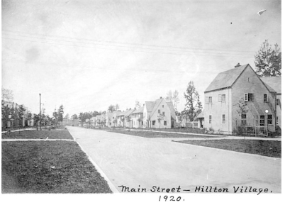
Hilton Village became the nation's first Federal war housing project. It was sponsored by the U.S. Shipping Board and the Shipyard in 1918 to house Shipyard workers. To link this new town with Newport News, a street car line was extended from North End of Newport News.
Municipal growth continued after World War II as new industries and residential areas were developed. Hidenwood became an established residential area. This historic acreage, formerly an extensive tract of Warwick County timberland known in Colonial days as Nutmeg Quarter, was developed by the Hiden Family between 1951 and 1957. The name honors Philip Wallace Hiden (1872-1936), who was a successful businessman, civic leader and Mayor of Newport News from 1920 to 1924 and his wife Martha Woodroof Hiden (1883-1959), who was a genealogist, historian, and founder of the City Library's Virginia collection.
Oyster Point was developed in 1971 by the City of Newport News as a regional industrial park on land which was once a federally owned ammunition depot. Oyster Point experienced significant growth through 2007. Its initial focus as industrial development that in later stages provide a higher percentage of office and office-warehouse uses. With 711 acres and approximately 3.1 million square feet of industrial, office-warehouse, and office space, Oyster Point is the largest business district on the Virginia Peninsula. Within the past decade, Oyster Point has taken on a new dimension. The development of City Center, 50 acres in the center of Oyster Point, has been developed into a mixed use center which includes residential apartments, offices, conference center and hotel, and small retail shops. Because of its geographic centrality, City Center functions as a central gathering place for many city events, including City government functions.
Issues
Current issues of Planning District II include:
- Maintain the integrity and quality of neighborhoods and protect them from incompatible infill development.
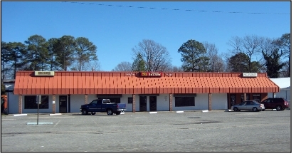
- Redevelop and improve the District's older commercial centers to create distinct centers by encouraging nodes of commercial uses to centers which will serve the surrounding communities.
- Provide recreational opportunities to include athletic fields for softball and soccer within the District to serve its diverse
population.
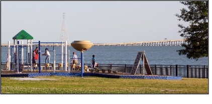
- Improve public access to the water and recreational opportunites within the District.
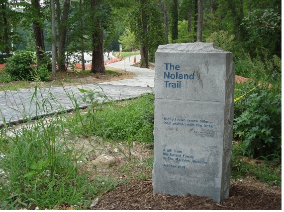
- Create and maintain a safe, identifiable trail network for bicycles and pedestrians which connects neighborhoods to the activity centers.
- Develop new industrial and commercial uses which will provide employment opportunities for the District's population while strengthening the District's regional employment character.