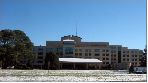
Activity Centers
Neighborhood Centers
Neighborhood centers are distributed throughout the District along major thoroughfares and collector streets. Each center reflects the character of the neighborhood it serves. Hilton Village neighborhood center contains service commercial uses with a community theater, restaurants and specialty stores. The centers vary in size from the smallest center with convenience grocery and gasoline services to the largest with full-service grocery and drug stores.
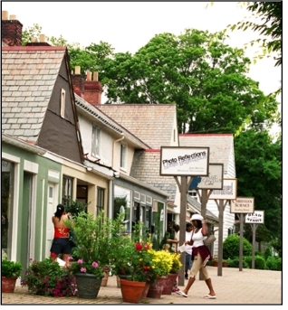
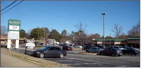
Port Warwick’s neighborhood center includes many retail services and office uses that serve not only its residents, but others in the City. However, some older centers require redevelopment because of their age, access problems, lack of consistency in signage and architecture and lack of pedestrian links to surrounding neighborhoods. The centers which require further planning include Sedgefield, Beaconsdale, Brentwood, and Hilton Green.
Community Centers
Planning District II contains five community centers: Kiln Creek, Hidenwood, Newport Square, Oyster Point Plaza, and Warwick Center/Warwick Village Center. Each center defines a broad section of the City while providing essential services.
- Kiln Creek: Kiln Creek is a newer retail-oriented community center. Its location, at the eastern gateway into the City, is one of its
strengths. The center provides a mixture of retail services and entertainment uses for its adjacent neighborhoods.
- Hidenwood Center: Hidenwood combines retail, office, financial, recreational, higher education, and government services in one area for the
benefit of the community it serves. These uses are located within proximity to one another but are not linked together by
their access, design of the buildings, or marketing. While the center is established, redevelopment is required for this center's
viability in the future; and, Christopher Newport University is playing a major role in revitalizing the Hidenwood Center.
- Newport Square: Newport Square is a retail-dominated community center. Its location, at the intersection of J. Clyde Morris Boulevard and Interstate 64, is one of its strengths. Further, it serves as a terminus for the commercial service corridor of J. Clyde Morris Boulevard. A redevelopment plan which takes advantage of the center's location is needed to link it with surrounding neighborhoods.
- Oyster Point Plaza: Oyster Point Plaza on Oyster Point Road is more suburban in character and contains a grocery store, other service oriented
commercial uses and a child care center.
- Warwick Center: Warwick Center includes the businesses in both the Warwick Village and Warwick Center Shopping Centers. This center serves the neighborhoods along Warwick Boulevard north of Mercury and south of J. Clyde Morris Boulevards. While its main focus is commercial, the center is adjacent to single family and multi-family residential, community facilities and industrial uses. The center has land ready for expansion and redevelopment. Any development that may occur behind the center, e.g., mixed use at Camp Morrison, should consider the center’s potential for connectivity to such development, to include pedestrian access and circulation.
Regional Centers
Planning District II has two of the regional centers of the City, i.e., Oyster Point/Middle Ground, Patrick Henry/Operations
Center, and borders a third (Newmarket) which is located in Planning District I.
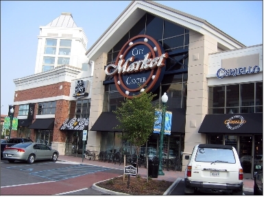
- Oyster Point/Middle Ground: Oyster Point, which originally was envisioned to be an industrial complex, has developed into a premier business park which serves as the City Center. Oyster Point contains a mixture of offices, warehousing, retail and service commercial uses, and residential uses. High density housing and commercial uses such as a high-rise office, retail, and hotel development are located within the "core" of Oyster Point known as “City Center”. Public plazas, the fountain lake, and other public spaces are components of this center. As the area continues to develop, Oyster Point will link to Port Warwick, west of Jefferson Avenue, when Middle Ground Boulevard is extended to Warwick Boulevard. Surrounding the mixed use City Center development will be other Class A office development, high density residential, more mixed use development, pedestrian greenways, and government uses such as a central library as City Center expands.
Recognizing the research and development nature of Canon Virginia, Inc., as well as the Thomas Jefferson National Accelerator
Facility, known as the Jefferson Lab, research and development uses may develop north of Middle Ground Boulevard as part of
this regional center. A “new urbanism” mixed use center is proposed west of Jefferson Avenue near the Middle Ground Boulevard
crossing of the CSX Railroad. This center will include offices, retail and restaurants, urban housing, and parks. A future
transit station is planned for this new crossing of the rail line. This center will connect to the existing multi-family residential
communities which surround it. This center should be further defined by a master development plan for the area which incorporates
the future transit station, parks, tree lined streets, and sidewalks serving the residential neighborhoods.
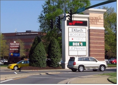
- Patrick Henry/OperationsCenter: Patrick Henry Regional Center has the Patrick Henry Mall as its core element. This center is composed of retail, office,
and service oriented commercial uses combined with single and multi-family residential uses and the community facilities such
as a church, school, and park. The Patrick Henry Regional Center has expanded with the mixed use development of Patrick Henry
Place. Eventually, the City owned Operations Center may become part of this complex as a transit oriented development with
access to a light rail station. Because of demand pressures from rising property values in this area, the Chesapeake Village
Mobile Home Park will be redeveloped in the future as Patrick Henry Place expands.
Employment Centers
Employment Centers are located throughout the District. Oyster Point and Patrick Henry Regional Centers are two of the largest employment centers for the District. Patrick Henry Regional Center, in conjunction with the industrial uses of the City's Public Works Operations Center and surrounding office uses, form the employment center.
Jefferson West: On the west side of Jefferson in the district directly across from Oyster point, there are industrial uses interspersed with multi-family residential uses and mobile homes. These are located between Jefferson Avenue and the CSX Railway from Muller Lane to Oyster Point Road. Warwick Mobile Home Estates will eventually be phased out and replaced with retail and/or residential, followed by industrial development closer to the CSX right-of-way.
Camp Morrison: Camp Morrison Industrial Park located in the Hilton area behind the Warwick Community Center is an industrial and warehouse area. The one hundred acre site has been used for industrial uses for many decades. However, a future mixed use development is a potential transition for this property. Future uses could include a mixed environment, such as light industrial, residential, and/or retail commercial.
Jefferson Center for Research and Technology: North of the Jefferson Lab, the Jefferson Center for Research and Technology is planned to develop on land in the Applied Research Center. The College of William and Mary Endowment Foundation property and the City's property at the Service Center for Operations and Transportation (SCOT) could be developed as this area of Oyster Point continues to attract more opportunities for high technology development and is conveniently located to the Peninsula’s central business district. Relocating the SCOT site will become a priority. Development of the William and Mary property and/or the SCOT site should enhance the Jefferson Center research park and be consistent with the City’s plans for light rail, specifically the A3 Alignment that is planned to serve these properties. The A3 Alignment is located on the District II Future Land Use Map and included in the Transportation Chapter
Riverside RMC. Riverside Regional Medical Center is a major hospital complex located at the southwest corner of Warwick and Avenue of the Arts. This center, which includes the Public Health Department, is expected to continue to develop its campus for future service to the Peninsula; and, the City should continue to beautify and enhance the Avenue of the Arts corridor.