
Parks and Open Space
The parks and open space in Planning District II are also discussed in the Parks, Recreation, and Tourism Chapter.
Parks
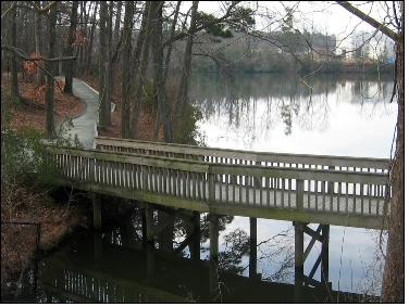
Planning District II has one major privately owned park with regional appeal, the Mariners’ Museum Park. The Planning District also has one public park, Deer Park, which is a large 50 acre district park.
Two new community parks are proposed for Planning District II. These parks are planned for the property south of Hines Middle
School on Jefferson Avenue and along the extension of Middle Ground Boulevard, on the west side of the CSX Railroad on the
Jewish Community Council property off of Spring Road. The Middle Ground Park would be located adjacent to the proposed transit
station and an existing multi-family residential community. These parks, with access from major thoroughfares, will contain
facilities such as community recreation centers, ball fields, and other recreational facilities which cannot be provided in
smaller neighborhood parks.
School sites serve as neighborhood parks for the District. Two new neighborhood parks are proposed to supplement the facilities
on school sites. Neighborhood parks could include playgrounds, picnic areas, ball fields, tennis courts, swimming pools and
landscaped areas.
- Hilton Village/Main Street Park. This park, which will be phased in over time, is a part of the plan for the historic Hilton Village commercial district.
It is located next to the Main Street Library.
- Deep Creek. A small neighborhood park is proposed on the north side of Deep Creek Road to serve the Chapel Park, Deep Creek and Hidden
Estates neighborhoods.
Recreation Centers
The Brittingham Midtown Community Center, located on McLawhorne Drive, is centrally located to the District. Recreation facilities include a 50 meter swimming pool, community rooms, basketball court with volleyball capabilities, walking track and a pavilion area for special events.
Greenways
Greenways are part of the plan for the Planning District. Greenways use rights-of-way adjacent to streams, power lines and drainage ways as natural areas, buffers and trail corridors linking residential neighborhoods and activity centers such as parks, schools, employment centers and community facilities. The bicycle and pedestrian access to these areas will be accomplished through public access easements or fee simple acquisition.
A ten-foot wide mulit-purpose trail is planned for construction on the west side of Warwick Boulevard along the Mariners’ Museum property from Avenue of the Arts Boulevard south to where Harpersville Road intersects Warwick Boulevard. The trail will connect an existing sidewalk network in this area and facilitate bicycle ridership. The trail will be constructed utilizing a Congestion Mitigation Air Quality (CMAQ) grant.
Natural Areas
Whenever possible, existing natural areas must be preserved to help define neighborhoods and activity centers and provide visual relief along major thoroughfares. All these areas are part of the network of open space throughout the City. The City owns 127 acres adjacent to LakeMaury on the Mariners' Museum property to be preserved as a natural area. Additional green space is occasionally acquired in the District by the Newport News Green Foundation.