Balanced Transportation
Streets
Interstate 64 and two arterial streets, Jefferson Avenue and Warwick Boulevard, cross the District. The east-west connector streets are Mercury Boulevard, Main Street, Harpersville Road, J. Clyde Morris Boulevard and Oyster Point Road. These streets provide further points of access for the District. There are several Transportation Plan improvements planned for the District.
Middle Ground Boulevard will be extended from Jefferson Avenue to Warwick Boulevard to create a new east-west connector for the City. The new connector will be a controlled access street. The Middle Ground Boulevard extension will include a landscaped buffer along both sides of the road and a separate bikeway.
The future widening of Harpersville Road to four lanes from Jefferson Avenue to Warwick Boulevard with a bridge over the CSX Railroad, will impact the neighborhoods of Robinson Terrace, Courtney Trace, East Morrison, Ivy Farms, Green Oaks and Beaconsdale.
Transit
The Peninsula Rapid Transit Project (PRTP) with feeder bus service that is envisioned as a long term alternative to the traffic congestion challenges in the City. In the long run, the project would utilize the CSX corridor as a main trunk line to move people north and south. Additional service lines would be added that would move people east and west and link major populations and destinations. When constructed, the system will efficiently move people between activity centers and other parts of the City and region. Transit stations are proposed at major east-west connector streets where land should be reserved for the transit stations. These transit sites lend themselves to Transit Oriented Development (TOD) which are mixed use, pedestrian oriented developments, generally located within one mile of transit stations.
The first installment of the PRTP would be a starter line (A3 Alignment) that would provide service to major employment centers and destinations located in District II, including: Christopher Newport University, Ferguson Center for the Arts, Riverside Medical Center, Oyster Point and City Center, Canon Virginia, Jefferson Laboratory, Patrick Henry Mall, Patrick henry Place, Wolesley North America Headquarters, Newport News/Williamsburg Airport, Mary Immaculate Hospital, and Huntinton Pointe. The proposed A3 Alignment and the PRTP project are described more in the Transportation Chapter.
Bikeways/Trails
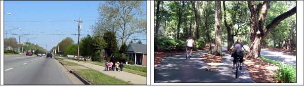
Safe and easily accessible bikeways and pedestrian trails are planned to connect activity centers with neighborhoods. New bikeways and pedestrian trails and their related facilities should be included in all development plans which impact the trail network. For example, bikeways are features in new road projects such as the Middle Ground Boulevard extension. Bikeways are shown on Bikeways Plan Map.