
Balanced Transportation
Interstate 64
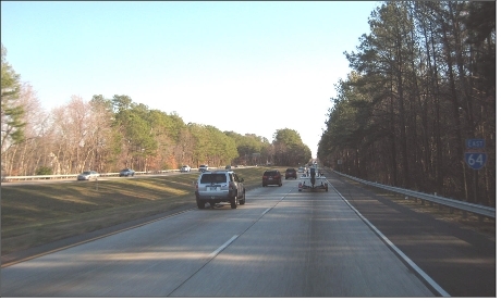
The Hampton Roads Regional Transportation Plan recommends widening I-64 to eight lanes (two HOV and 6 SOV lanes) from Jefferson Avenue to Route 199 in James City County. The design, engineering, and construction of I-64 should avoid widespread tree destruction, preserve the treed buffer in the median, and protect the Lee Hall Reservoir during the widening. Bridges, retaining walls, sound walls, guard rails and other features should also be designed to be attractive, enhancing the appearance of I-64 because it is a major gateway into the City. To protect trees and the median, and obtain higher levels of design, the City should have VDOT to include a landscape architect with the design team during engineering design of the I-64 widening project.
Interstate Interchanges
A new multi-modal urban interchange is being designed at Bland Boulevard and Interstate 64 to access the airport. This location will provide not only a highway interchange, but also a light rail and higher speed rail station with bus connection and commuter parking. The interchange received funding earmarked by the Transportation Equity Act (TEA-21) but the cost exceeds the funds accumulated. The design of the interchange should be an attractive urban type diamond to minimize land requirements.
The I-64/Fort Eustis Boulevard Interchange will be reconstructed as part of the I-64 widening project. Because of its proximity to the Lee Hall Reservoir, its design and construction should be environmentally sensitive and carefully built.
Unlike the I-64/Jefferson Avenue Interchange reconstruction, collector/distributer lanes should not be built on other Interstate 64 interchanges in the City. This will minimize land requirements, reduce tree destruction, and lessen the large amount of stormwater runoff from the impervious surface. Both the Bland Boulevard and Fort Eustis Boulevard interchanges should employ an urban design to further reduce land coverage and the need for excessive right-of-way.
The Atkinson Boulevard interchange, although not on federal or state plans, is needed to divert future traffic off the Fort Eustis Boulevard.
Interchange modifications are proposed at Yorktown Road and I-64. These modifications will move the east bound on-ramp further west on Yorktown Road to allow for stacking and lengthen the acceleration and deceleration lanes on I-64.
Arterial Streets
The following arterial street improvements are recommended in the Plan for Planning District IV.
- The widening project of Jefferson Avenue between Buchannan Drive and Fort Eustis Boulevard.
- Yorktown Road between the Southern Lee Hall Bypass and Crafford Road will be widened. The Asheton development will realign
a portion of Yorktown Road, which will alter the original design.
- The southern by-pass road will eliminate the need to widen Yorktown Road through Lee Hall Village and eliminate at-grade railroad
crossings at Elmhurst Street and Yorktown Road.
- Fort Eustis Boulevard east of Jefferson Avenue to Route 17 in York County will be widened to four lanes with a median.
- Atkinson Boulevard between Warwick Boulevard and Jefferson Avenue is under preliminary design. Atkinson Boulevard between
Jefferson Avenue and Fort Eustis Boulevard will cross environmentally sensitive lands, but is necessary.
- Independence Boulevard, (Denbigh-Fort Eustis Connector), will be built with the Huntington Pointe development. It is proposed as a four lane divided arterial that will link Denbigh Boulevard with Fort Eustis Boulevard.
Collector Streets
The Richneck Road project Phase 1construction will start in 2008. Richneck Road project Phase 2 design planned to begin in 2010. Storm sewers, sidewalks, and traffic calming have been incorporated into the design and construction. Richneck Road will be realigned to connect to Independence Boulevard during Phase 2 the Huntington Pointe Development.
The Federal Aviation Administration approved a master plan for the Newport News-Williamsburg International Airport that requires the extension of runway 2-20 across Oriana Road. In the future, Oriana Road will dead end in a cul-de-sac near the Newport-News City /York County Line.
All future major arterial and collector street projects should include sidewalks, bicycle lanes and landscaping.
Streets and highways are discussed further in Chapter 4 on Transportation.
Rapid Transit
Commuter rail and rapid transit are planned in the CSX corridor, with transit stations located at Bland Boulevard, Denbigh Boulevard, Atkinson Boulevard, and Lee Hall.
Future transit station sites should be acquired in advance, and existing city owned sites reserved for future transit stations. Plans should be prepared for each station site. The stations should be designed with landscaping around buildings and in and around parking lots. Station sites should be designed to accommodate park and ride facilities, bike racks, and covered waiting areas at bus stops; thus, they will be destinations on local bus routes and connected to bike lanes and trails.
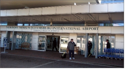
The A3 Alignment for Rapid Transit proposes transit stops at Bland Boulevard, with connection to commuter rail, Ferguson-Wolseley, Newport News/Williamsburg Airport, Mary Immaculate Hospital, and Huntingon Pointe.
Bikeways/Trails
The planned greenway system and streets provide the City with corridors for walking and biking. Greenways will be studied for bike or hiking trails.
Bikeways in Planning District IV will connect employment centers to the residential areas and activity points in other districts. All the major arterial construction projects planned for the district will include a bike trail or lane as part of the design. The Jefferson Avenue sidewalk will be widened to eight-feet to accommodate bicycle riders.